Map
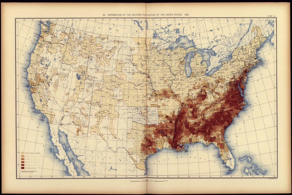
Distribution of the Colored Population of the United States: 1890
An 1890 map showing the relationship between white and non-white populations “including all persons of Negro descent, Chinese, Japanese, and civilized Indians,” according to statistics from the 11th census.
Link with href
As included in the 1890 Statistical Atlas of the United States. Library of Congress.